


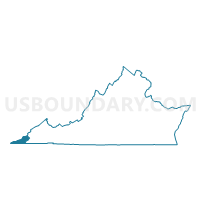
Dryden Voting District, Lee County, Virginia
About
Outline

Summary
| Unique Area Identifier | 682013 |
| Name | Dryden Voting District |
| County | Lee County |
| State | Virginia |
| Area (square miles) | 19.55 |
| Land Area (square miles) | 19.39 |
| Water Area (square miles) | 0.16 |
| % of Land Area | 99.20 |
| % of Water Area | 0.80 |
| Latitude of the Internal Point | 36.77310120 |
| Longtitude of the Internal Point | -82.92602220 |
Maps


Graphs
Select a template below for downloading or customizing gragh for Dryden Voting District, Lee County, Virginia


Neighbors
Neighoring Voting District (by Name) Neighboring Voting District on the Map
- East Pennington Gap Voting District, Lee County, VA
- Jasper Voting District, Lee County, VA
- Robbins Chapel Voting District, Lee County, VA
- Seminary Voting District, Lee County, VA
- Stickleyville Voting District, Lee County, VA
- Stone Creek Voting District, Lee County, VA
- Woodway Voting District, Lee County, VA
Top 10 Neighboring County Subdivision (by Population) Neighboring County Subdivision on the Map
- District 3, Lee County, VA (7,268)
- District 4, Lee County, VA (4,813)
- District 5, Lee County, VA (3,541)